Madeira archipelago • Autonomous Region
The Madeira Autonomous Region is a portuguese group of islands in the Atlantic Ocean, distinguished by two inhabited main islands, Madeira and Porto Santo, and two groups of uninhabited islands, the Desertas and Selvagens.
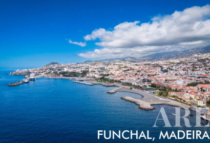
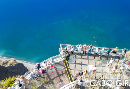
It has beautiful mountains, colorful flowers, and warm weather. Madeira is famous for its tropical fruits, sweet wine, and fun wicker toboggans. Visitors love hiking in forests, swimming in natural ocean pools, and exploring Funchal, the main city, with its markets, gardens, and a museum about soccer star Cristiano Ronaldo.
| Island | Largest City | Second-largest City | Third-largest City | Fourth-largest City |
|---|---|---|---|---|
| Madeira | Funchal | Câmara de Lobos | Santa Cruz | Machico |
| Porto Santo | Vila Baleira | — | — | — |
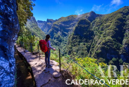
Classified has a UNESCO World Natural Heritage Site since 1999, Madeira is renowned for its Laurissilva forest, verdant and colorful flora, and variety of fruits. It attracts walkers with the Levada paths of Caldeirão Verde around Pico Ruivo, Pico do Arreiro, and Pico Ruivo do Paul, featuring abundant water and waterfalls. The island offers luxury hotel services, impeccably clean streets, polite people, and delicious cuisine. It’s a prime destination for sportsmen, surfers, nature lovers, and boasts spectacular New Year’s Eve fireworks.
With rich biodiversity and warm ocean waters, Madeira is a paradise in the Portuguese Atlantic.
Madeira has 11 Municipalities… here’s the Map
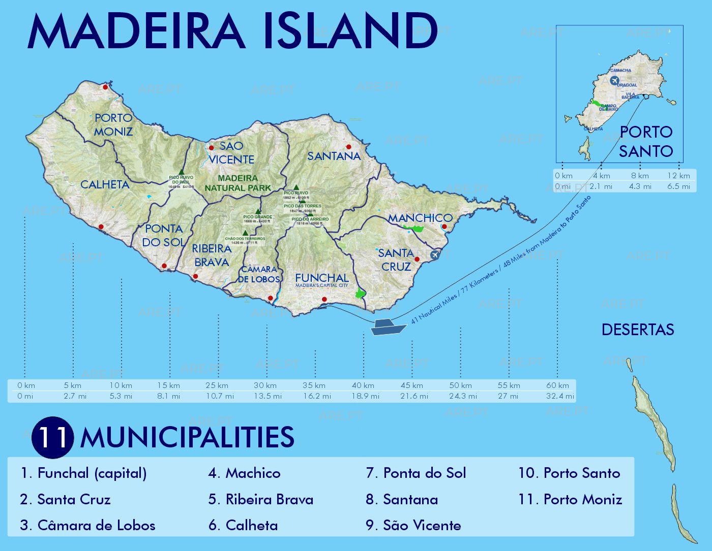
What Are Each Madeira Municipality’s Main Characteristics?
- Funchal, the capital on the southern coast;
- Santa Cruz, east of Funchal with Madeira Airport;
- Câmara de Lobos, located west of Funchal, is known for its traditional fishing village and extensive vineyards. It is also famous for the local specialty, “espetada em pau de louro” (skewered meat on a bay laurel stick);
- Machico, on the eastern coast where Madeira was first landed;
- Ribeira Brava, on the southwestern coast with scenic valleys;
- Calheta, further west with an artificial beach and sugar cane production;
- Ponta do Sol, between Ribeira Brava and Calheta known for its sunny climate;
- Santana, on the northern coast with traditional thatched houses;
- São Vicente, in the north-central part with volcanic caves;
- Porto Santo, an island municipality with a long sandy beach;
- Porto Moniz, on the northwestern tip with natural volcanic swimming pools