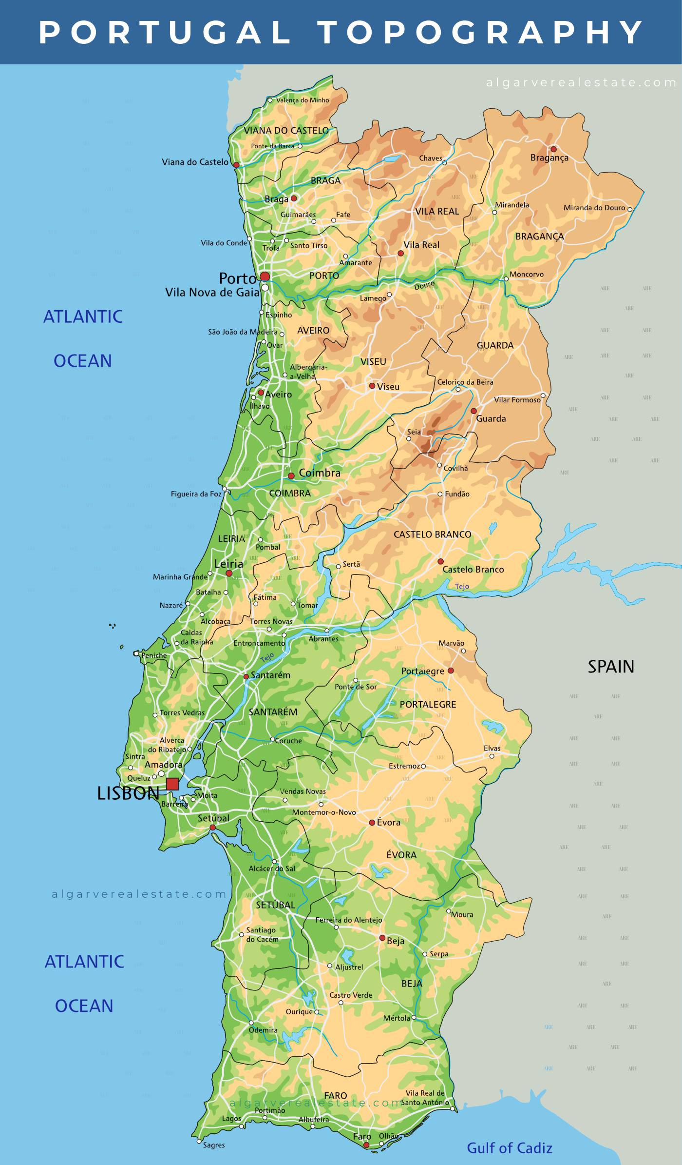
Portugal is a small country, divided into 7 regions, each further subdivided into districts, with its own unique characteristics and attractions that distinguish them from each other. One main difference that can be used to distinguish the regions is their geography and topography.
The Lisbon and Tagus Valley region is dominated by the Tagus River, which flows through the center of Lisbon and influences the region’s landscape and culture.
The Centro region is known for its central location and diverse landscapes, from the coastal beaches of Aveiro to the snowy mountains of Serra da Estrela.
The Alentejo region is known for its vast open landscapes, fields of cork trees, vineyards, and olive groves.
The Azores and Madeira regions, being islands in the middle of the Atlantic Ocean, have distinct geography, biodiversity, and cultural heritage.
Portugal’s Diverse Topography
Portugal’s topography is diverse, with a range of mountainous regions, rolling hills, and coastal plains, all stretching along the Atlantic Ocean.
The Norte region is located in the mountainous region of northern Portugal, is known for its mountainous landscapes, particularly the areas around the Douro Valley, with a cooler and wetter climate than the Algarve region in the south, which has a warmer and drier Mediterranean climate. The city of Porto is part of this region. The northern part of the country boasts mountain ranges like the:
- Serra do Marão,
- Serra do Gerês, and
- Serra da Estrela, which is mainland Portugal’s highest mountain range, with its highest peak reaching an altitude of 1,993 meters (6,539 feet).
The central region of Portugal is characterized by rolling hills and low-lying plains, and is home to the Tagus River, which runs through the country and forms a vast valley flowing through the capital city of Lisbon. This region is diverse, with a range of landscapes that include the coastal city of Aveiro, often called the “Venice of Portugal” due to its canals, and the Serra da Estrela, the highest mountain range in continental Portugal.
Meanwhile, the southern region of Portugal, the Algarve, is famous for its 100’s of kilometers of beaches and is characterized by a series of low-lying coastal plains, cliffs, and rocky outcrops. The region is also home to the Serra de Monchique, serra Espinhaço de Cão, and serra do Caldeirão, a small mountain chain that separates the Algarve from the Alentejo to the north. The Serra de Monchique starts in Monchique and extends to Cachopo, near Tavira, offering stunning views of the surrounding countryside. The region’s topography is characterized by rolling hills and rugged terrain, with the highest peak in the Serra de Monchique reaching over 900 meters in elevation. The unique topography, combined with the warm climate, makes this region a popular destination for outdoor activities and a haven for those seeking a break from the colder weather in other parts of the country.